 Kellisa started her 2009 summer vacation with a trip to New England. Lisa stayed home in Florida with grandma. We flew to Manchester, NH and headed north to the Highpoint of NH. Along the way, we stopped at Franconia Notch, which was the site of the Old Man of the Mountain until it collapsed on May 3, 2003.
We had two choices for the route to the NH summit, the Cog Railroad or the Auto Road. We chose the railroad because Kellisa has been enjoying train rides. While waiting for our train ride, Kellisa wheels around with Mount Washington in the background:

Kellisa in front of the train we would take to the summit:

Kellisa enjoying the steep ride to the top:

The view up the tracks:

Mount Washington's summit is home to some of the worst weather in the world. The summit averages 110 days of hurricane force winds and has 21.2 feet of snow each year. Some extremes recorded: 231MPH wind (world record for earth's surface), -50F temperature and -103F wind chills.
Our summit picture:
 By local standards, our weather was mild during our visit: the temperature was in the 40's and the wind was only 40-55MPH. A little shocking considering we woke up in Florida that day.

Between the popularity, height and weather extremes of Mount Washington, many people have died on the mountain:

Kellisa enjoying the swing outside our cabin in Littleton, NH:

We were hoping to summit Vermont, but I was not able to get Kellisa up the trail. I'm thinking it is possible with a yet to be invented off road chair and/or help. I'm looking for a volunteer...Matt?
 By local standards, our weather was mild during our visit: the temperature was in the 40's and the wind was only 40-55MPH. A little shocking considering we woke up in Florida that day.
Between the popularity, height and weather extremes of Mount Washington, many people have died on the mountain:

Kellisa enjoying the swing outside our cabin in Littleton, NH:

We were hoping to summit Vermont, but I was not able to get Kellisa up the trail. I'm thinking it is possible with a yet to be invented off road chair and/or help. I'm looking for a volunteer...Matt?
Kellisa with Vermont's Highpoint, Mount Mansfield in the background:

Lisa's friend Angie had read an article online about a newly opened section of the Appalachian Trail in Vermont that was wheelchair accessible. We were close, had time, so we made our way to the trail. It's a boardwalk and path along the Ottauquechee River and leads to the base of Thundering Falls.


The highpoint of Massachusetts was our next destination. We drove through clouds on our way to the summit.

MA summit photo:

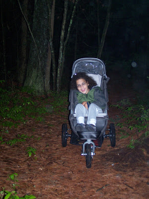
We still had to drive to the Rhode Island Highpoint as it was getting late and rainy. We drove through the corner of Connecticut on the way to the smallest state. The RI HP is on private property and they ask you to visit during daylight hours. This was not going to be possible. Considering how far we traveled, the trail was short and I knew we would not disturb anything or anyone, I decided to go for it in the dark:

Lisa's friend Angie had read an article online about a newly opened section of the Appalachian Trail in Vermont that was wheelchair accessible. We were close, had time, so we made our way to the trail. It's a boardwalk and path along the Ottauquechee River and leads to the base of Thundering Falls.


The highpoint of Massachusetts was our next destination. We drove through clouds on our way to the summit.

MA summit photo:

We still had to drive to the Rhode Island Highpoint as it was getting late and rainy. We drove through the corner of Connecticut on the way to the smallest state. The RI HP is on private property and they ask you to visit during daylight hours. This was not going to be possible. Considering how far we traveled, the trail was short and I knew we would not disturb anything or anyone, I decided to go for it in the dark:

Sitting on the summit rock:

While looking at a map of RI, I saw an island just off the main land. It was Block Island. I did a little research and it seemed like a good way to spend our last day. It started off with a high speed boat trip of 13 miles to the island. On the boat:

Without plans, we just started walking around the island once we got there. The island has been left in a natural state with estate size houses dotting the landscape. Block Island was named by the The Nature Conservancy as one of twelve sites in its list of "The Last Great Places" in the Western Hemisphere. View from the roadside out over the ocean:

Steep bluffs and Southeast Lighthouse:

Kellisa enjoying the trail along the bluffs:

A deer watching us pass a roadside preserve:
 Kellisa pointing to the little crabs running around on the beach:

 Kellisa pointing to the little crabs running around on the beach:
Trip totals: 716 miles driven, 5 new states for Kellisa (NH, VT, MA, CT & RI), 3 Highpoints (NH, MA, RI) and 2 new airports for Kellisa (Manchester & Providence).
No comments:
Post a Comment